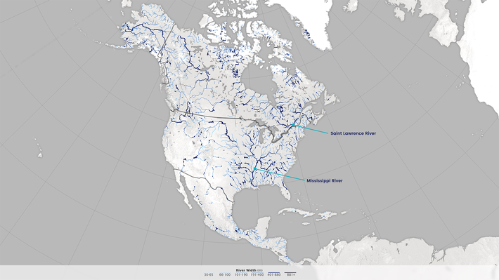
 From WGBH - "The size of a river is traditionally estimated using water volume calculations, and topographic maps that show physical land features. This traditional approach often yields less accurate measurements, and if rivers are in hard-to-reach areas, they cannot be measured at all. Recognizing the need for more accurate and comprehensive estimates, hydrologists at the University of North Carolina used data and images from NASA Landsat satellites to develop a new database of North American river widths, which is useful for observing the distribution and connections among rivers in North America. Designed for grades 3-5."
Link to resources: http://bit.ly/PBSRiverWidths
Publish Date:
Monday, July 3, 2017 - 10:15am